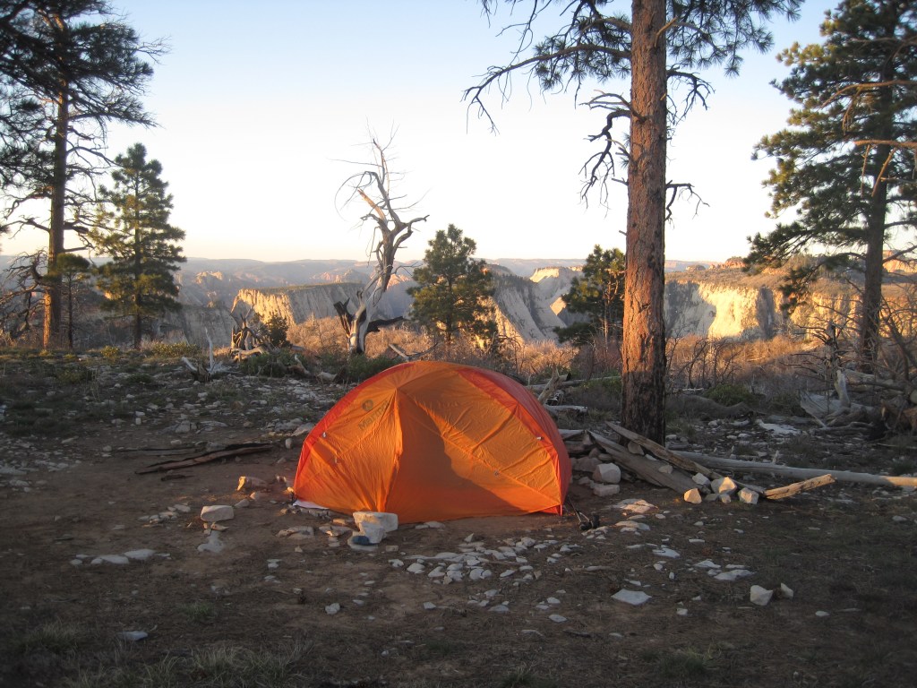
Walk with us through spontaneous and unapologetic adventures. Join us in budget minded Sprinter DIY successes and failures: Sleeping 4 in a Sprinter 144.
Rambling Footsteps are participants in the Amazon Services LLC Associates Program, an affiliate advertising program designed to provide a means for sites to earn advertising fees by advertising and linking to Amazon.com and affiliated sites.
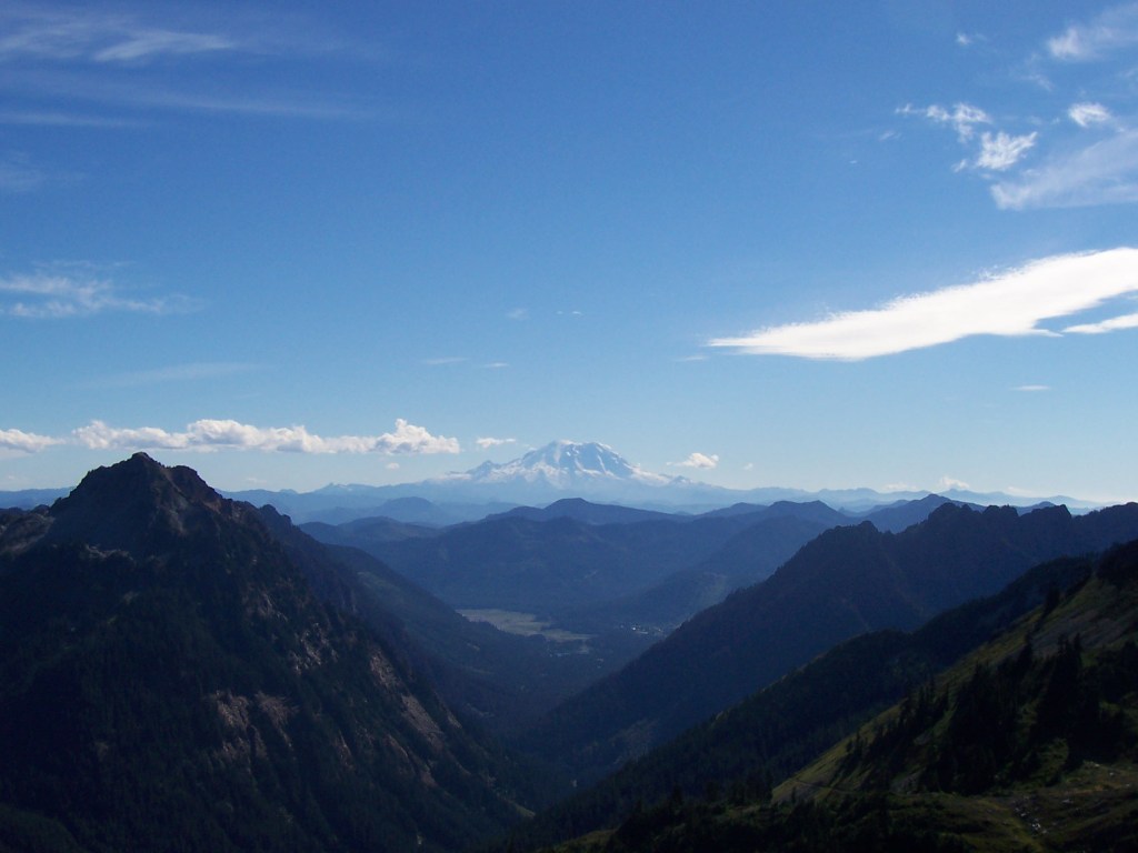
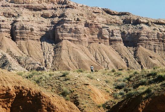
We had been on the road for more than two months. We were eager to get home and anxious to be on the road when we found ourselves in Colorado with our “check engine” light on. Thankfully, family loaned us a car so we could set off on some day trips! Florissant Fossil Beds National Monument is less an hour drive from Colorado Springs. It was one place that we had yet to explore.
Here are 6 reasons that we are glad we did!
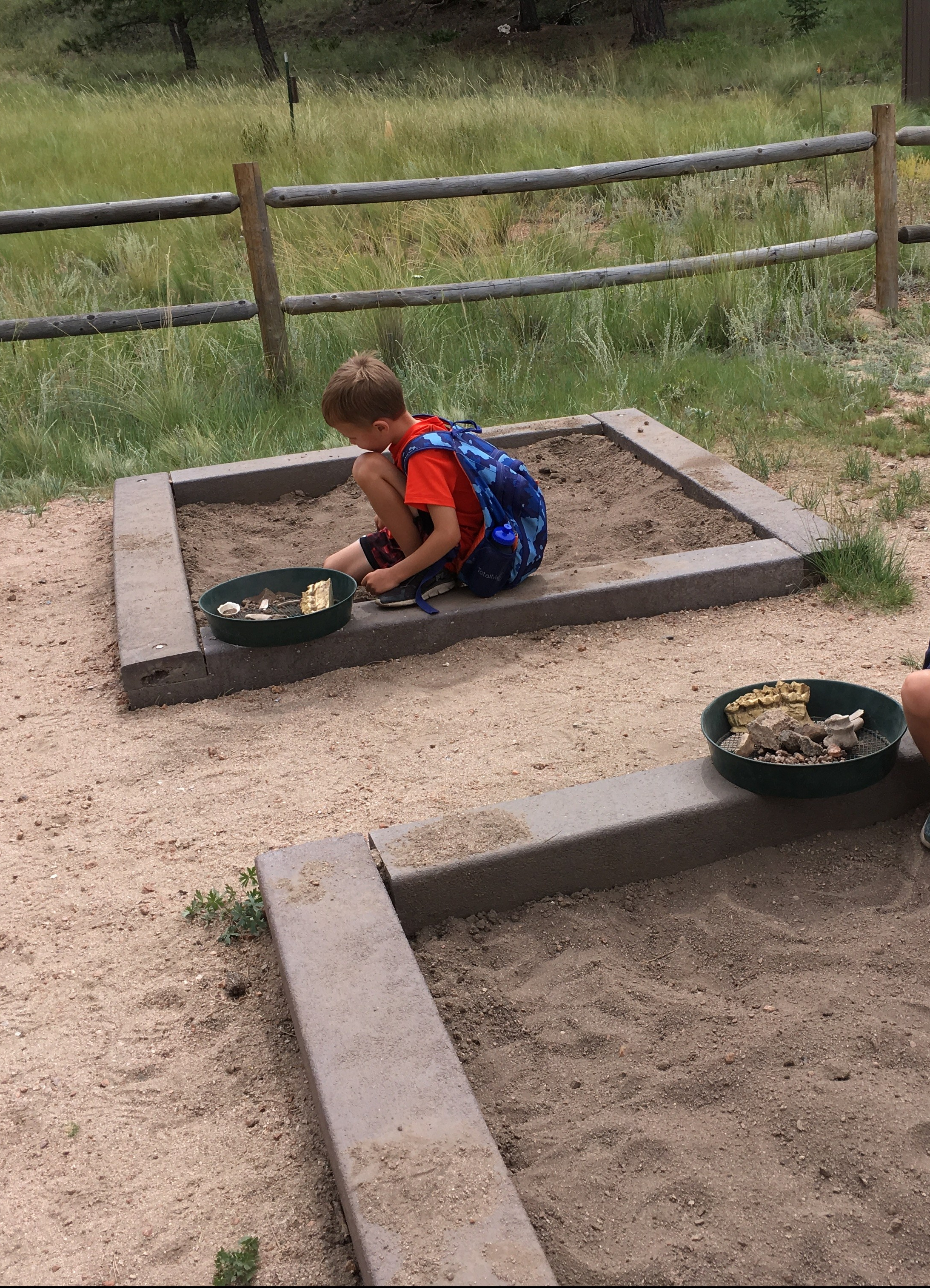
1. Hands-on Activities
The variety and depth of hands-on experiences were more than expected. We joined the kids for one lap around the visitor’s center and nearby yurt before they settled into their activities of choice. From digging for fossils, to sorting rocks, we spent much more time here than planned.
We loved looking at fossils and rocks also.Fossil sites are fun for digging also!
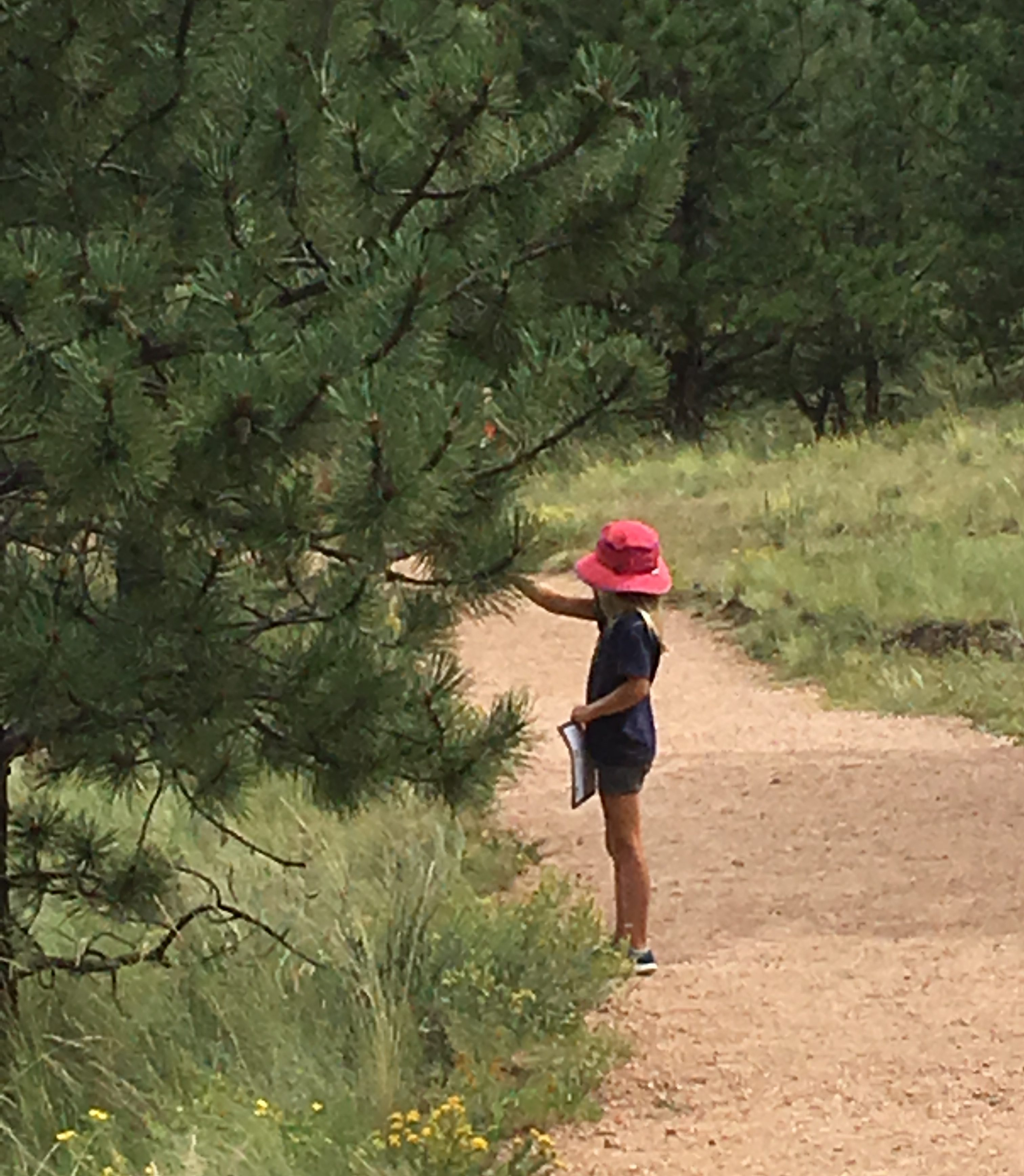
2. Hiking
I was glad to find more than 10 miles of trails to hike! In addition to meadows, you can find pine forests and boulder fields. The views are much different than those just a short drive east.
Not just fun hiking, the views are great too!
3. Self Guided Walking Tours
The walking tours are easy to follow and full of fun facts also.
Check out the tour, its worth it!
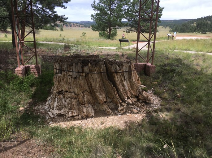
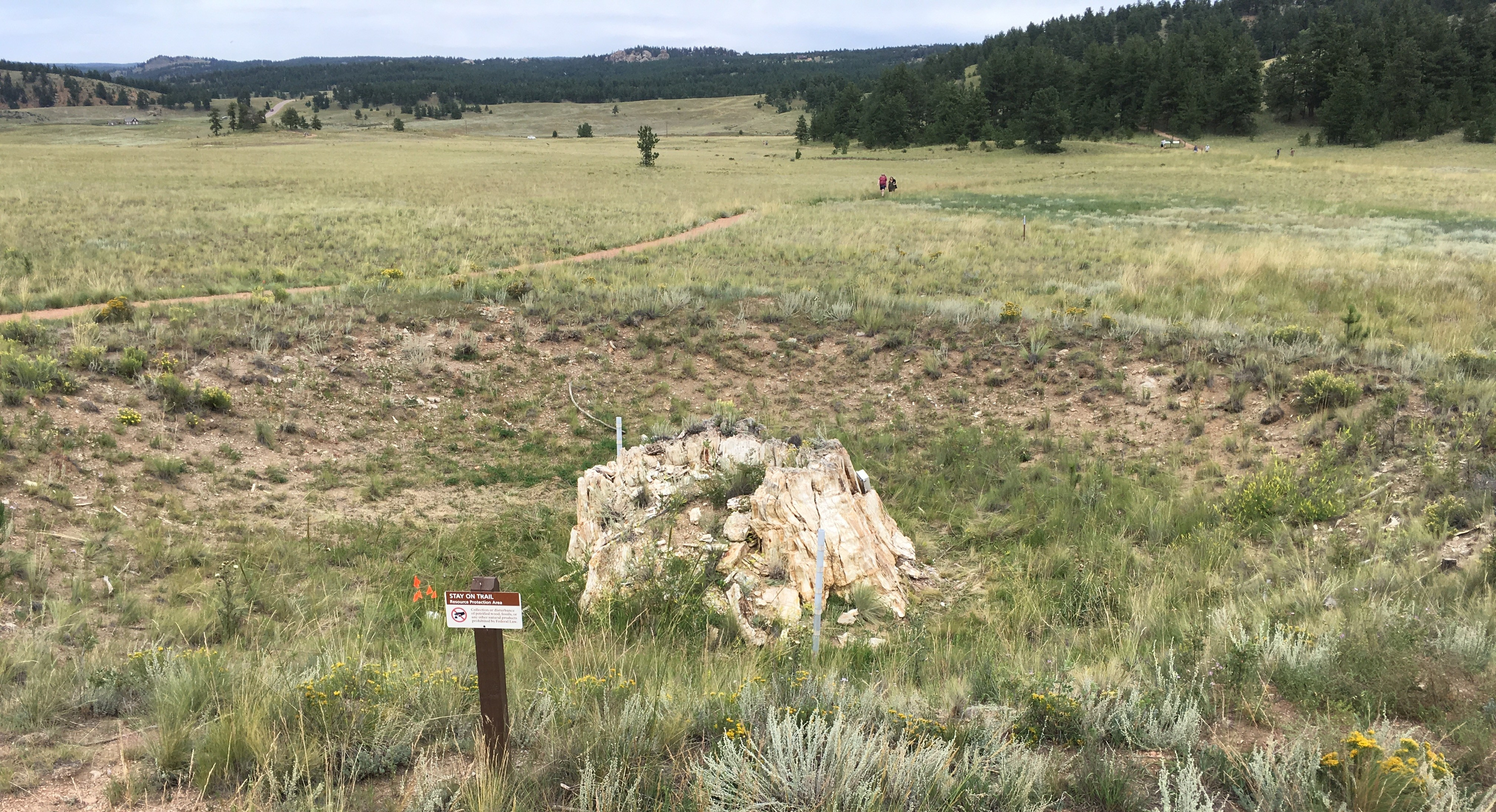
4. A Petrified Redwood Forest at the Fossil Beds
I expected to see fossils but I didn’t expect an ancient lake and forest!
This may be the best old forest of all time. We all agreed, by the way.This “big stump” didn’t fit in the scene where it was stood but we thought it was cool.Also, an old forest was there. The kids liked it too, however!
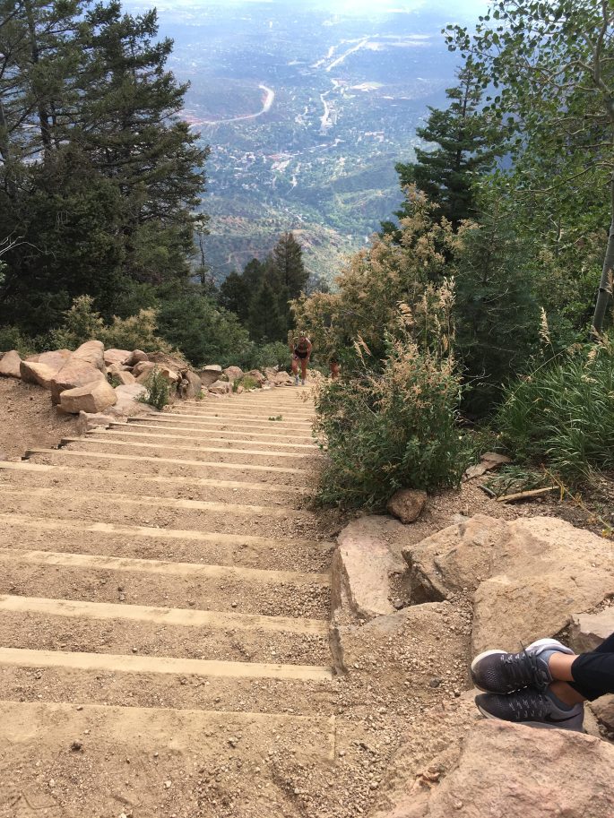
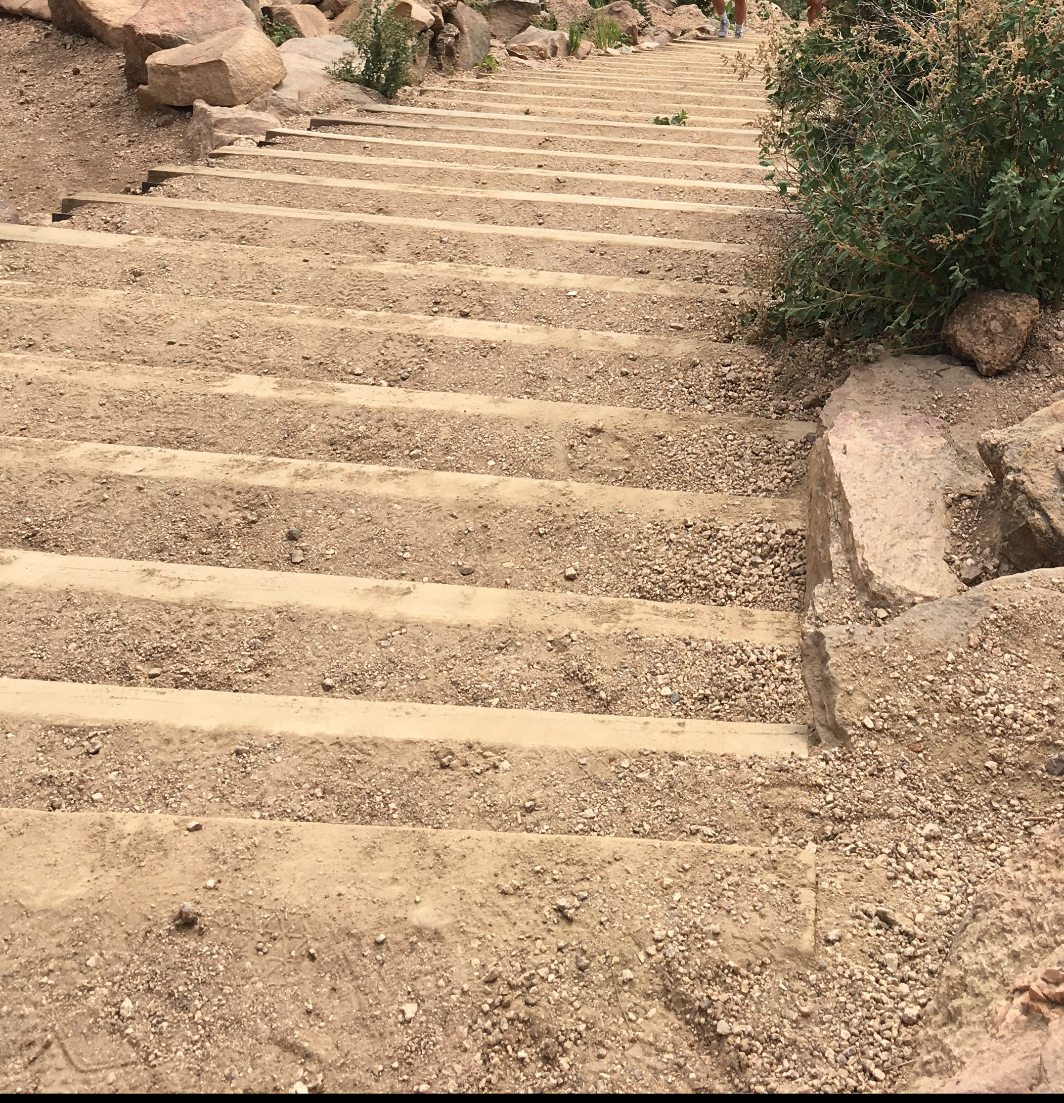
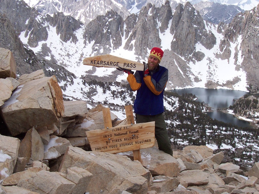
The Manitou Incline is well known among Colorado Springs locals. It is the remains of a narrow gauge railway that was built in 1907 and destroyed by a rock slide in 1990. The rails were removed and the rail road ties remain.
Until 2013 locals and fitness enthusiasts would walk past “no trespassing” signs to hike up the remains. CD and I were among the people that made this trek and did so without injury.
It has since been repaired and officially opened to the public. Thanks to this restoration, the trail is much more safe which still being sufficiently challenging.
Manitou Incline Stats:
Altitude at the base: 6600 ft
Ascent: 2011 ft
Distance: 0.88 miles
Steps: 2744
Grade: up to 68%
Getting There:
By car: Manitou Springs is a 20 minute drive from Colorado Springs
The town of Manitou Springs offers various parking options. A free shuttle bus runs to the incline every twenty minutes year round. I have also walked the approximately 1.5 miles to and from town but I thinking that the shuttle bus looked like a nicer option!
Advertisements
Advertisements
Packing List:
Sunscreen
Hat
Trekking poles
2 poles. Seriously – you will thank me later!
Water
To drink and to pour on yourself if are still there when the sun hits!
Snacks
I recommend a piece of fruit for a picnic at the top!
Camera
A friendly smile and a social attitude
Everyone is in this together! You will find that people are chit chatting and encouraging each other the whole way. It is the best!
Trip Planning And Other Tips:
Start early if you can
I usually don’t start early enough and end up mid incline in the hot sun. Be aware that there isn’t any shade. You can duck off to the side in the trees a bit but it won’t offer much relief.
Embrace the community! Talk to people. Give encouragement. Accept encouragement. Smile. Laugh, sweat, and cheer together!
Going down will take longer than going up. They don’t allow walking down the incline so be ready to hike the Barr Trail down.
Know that there is a bail out spot half way up. It connects back to the Barr Trail and heads down. If you can make it, keep going slow and steady. The view from the top is impressive.
Be aware of the false summit. Just like most mountain hikes, the incline offers false hope. For this hike you are pretty much always “almost there”.
Don’t be afraid to be slow and steady. I have climbed it fast and climbed it slow. Both have been great. In terms of the actual time, slow and fast aren’t really that different. Enjoy!
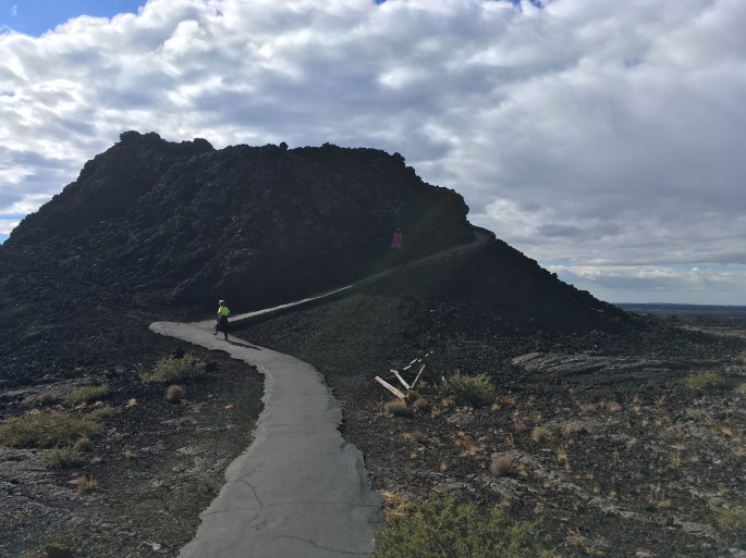
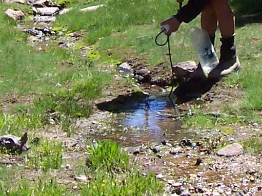
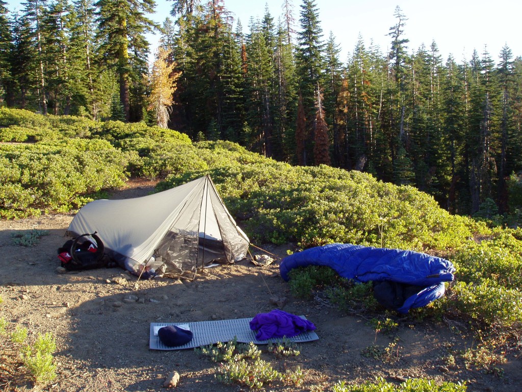
It was dark, the kids were asleep, and we were driving through the same part of Idaho that we had many times before. We hadn’t decided where to camp or how long to drive so we exited the highway, towards Craters of the Moon National Monument.
Our Sprinter van was the reason we made this choice; we didn’t have cell service, there weren’t any hotels, and I had not idea if there was anywhere to sleep once we got there. It turns out that the closest hotels are more than 30 miles from the park and the campground was full.
We parked our van near the visitor’s center and settled in for the night.
The next day we work up and it looked like we were on the Moon. The kids were amazed and excited all at once!
It looks like I imagine the moon!
5 Helpful Tips For 1 Day At Craters of Moon National Monument.
Plan where to stay. The campground is small and may be full. Other lodging options are approximately 30 miles away.
Craters of the Moon
2. Check out the visitor’s center! Not only can you get your National Parks Passport stamp and your Junior Ranger badge but it has displays, movies, and activities for everyone!
3. Bring a headlamp! The lava tubes are a must-see. The caves trail offers easy access. You must get a Caves Permit prior to entering the caves. The permit is free.
caves: lava tubescaves.
4. Prepare for the elements. Bring a jacket if it is windy and a hat if it is sunny. The trails are exposed and you will be out in the weather.
sun. wind. moon rock. the kids loved it!walk on the moon on a clear day
5. Bring food and drinks. It takes a bit to get back to town to the East and even longer to the West. There aren’t restaurants or gas stations right there so pack a lunch, grab a picnic table, and enjoy!
Advertisements
Advertisements
a nice walk on the moon on a clear day. the kids ran part of the way.
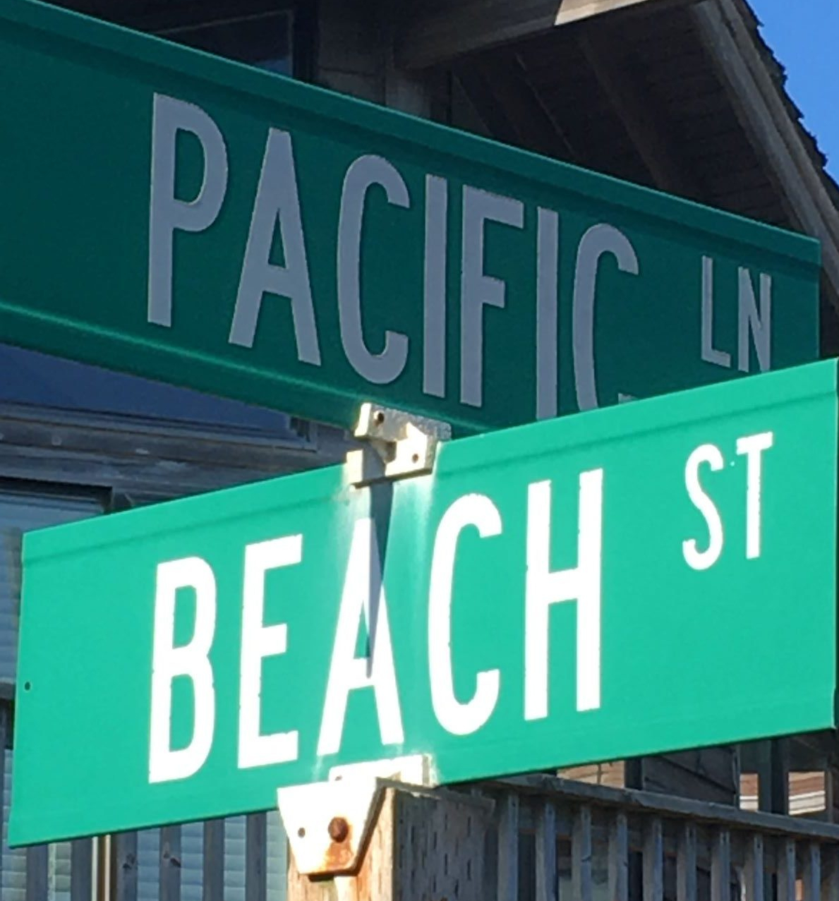
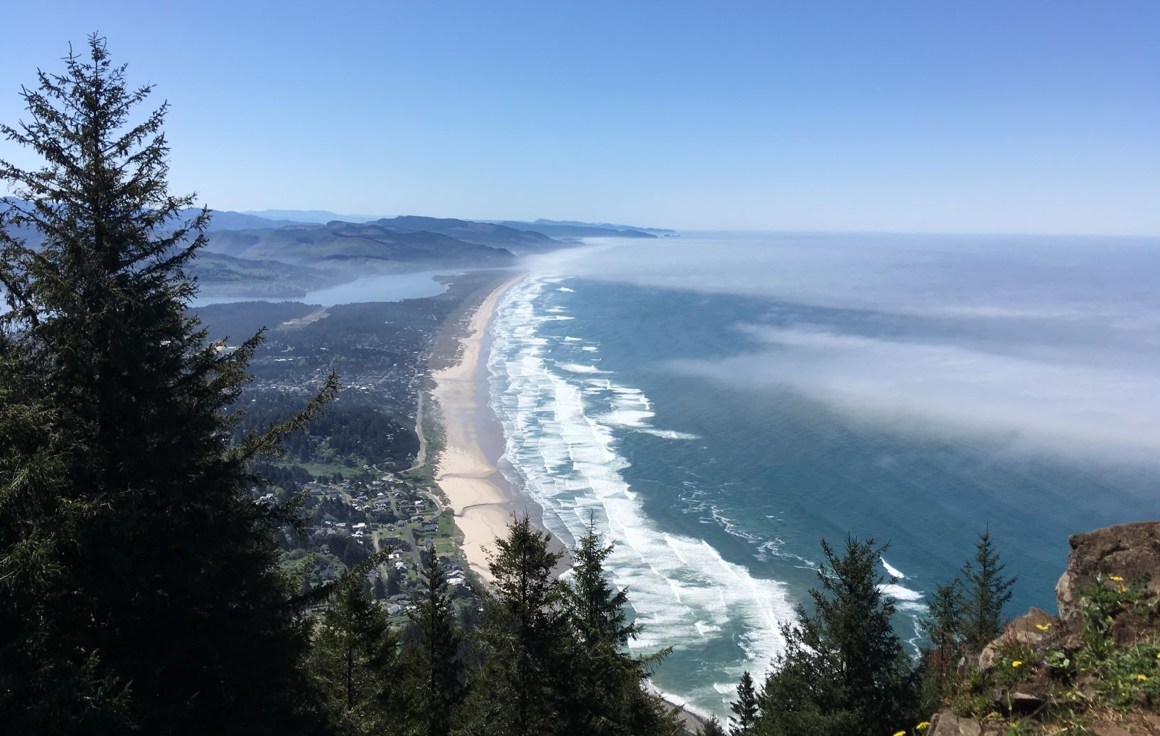
It is well known that the Oregon coast if full of breathtaking scenery and widespread ocean access. Hidden among the 362 miles of Oregon’s coastline is the town of Manzanita.
Manzanita is in Tillamook county, north of Lincoln City and south of Astoria. It is home to seven miles of coastline and beaches. With a population only in the triple digits, the effects of tourism are obvious. The benefits to those that vacation there are great.
The Main Street
Lenada Avenue is the heart of downtown. Restaurants, coffee houses, and shops have names like Left Coast Siesta, Neahkanie Bistro, Bread and Ocean Bakery, and MacGregor’s: A Whiskey Bar.
The Beach, Oregon’s Coast
From town, the beach is steps away. Our Meredith Lodging rental house was across from Hallensted Park, 6 blocks from the main street and two blocks from the beach.
This sign says it all! Great beaches!The main road from town ends where the other people are standing. Oregon’s Coast.
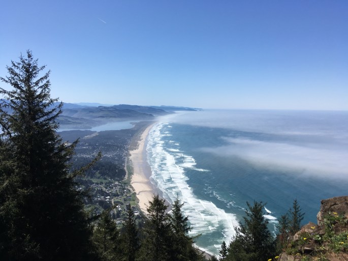
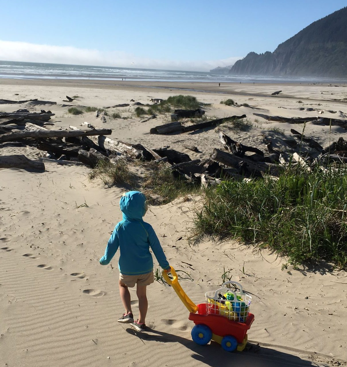
NeahKahnie Mountain
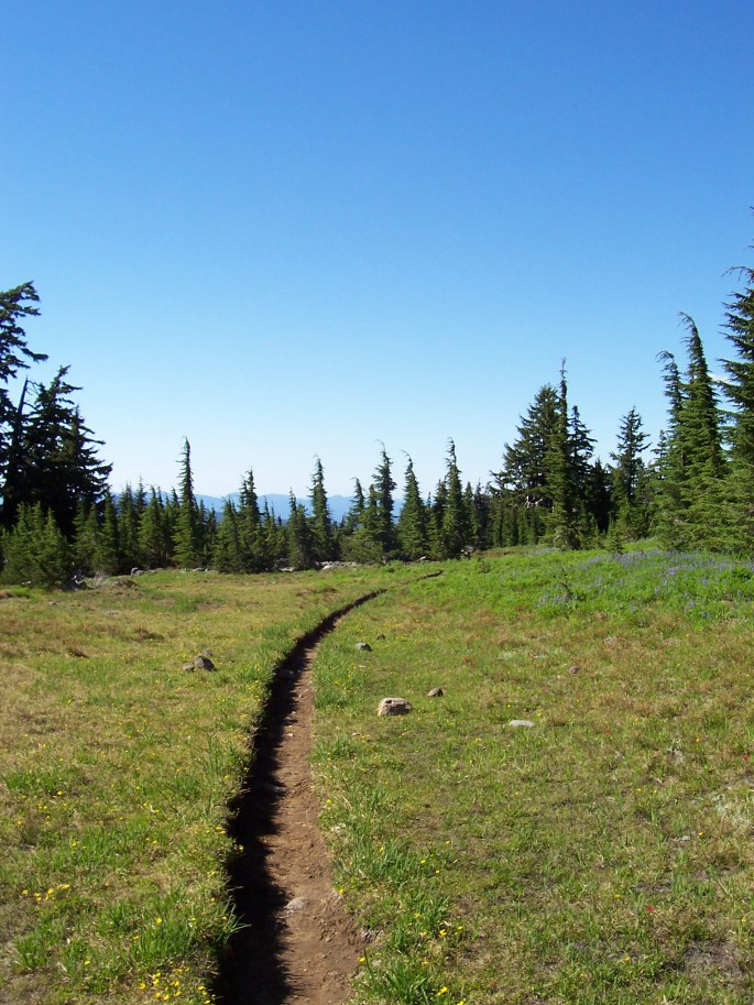
Don’t miss this hike! Oswald State Park offers a 8 mile long mountain loop trail or a 2.8 mile shorter version. The trail is well taken care of and inviting.
The trees are welcoming also
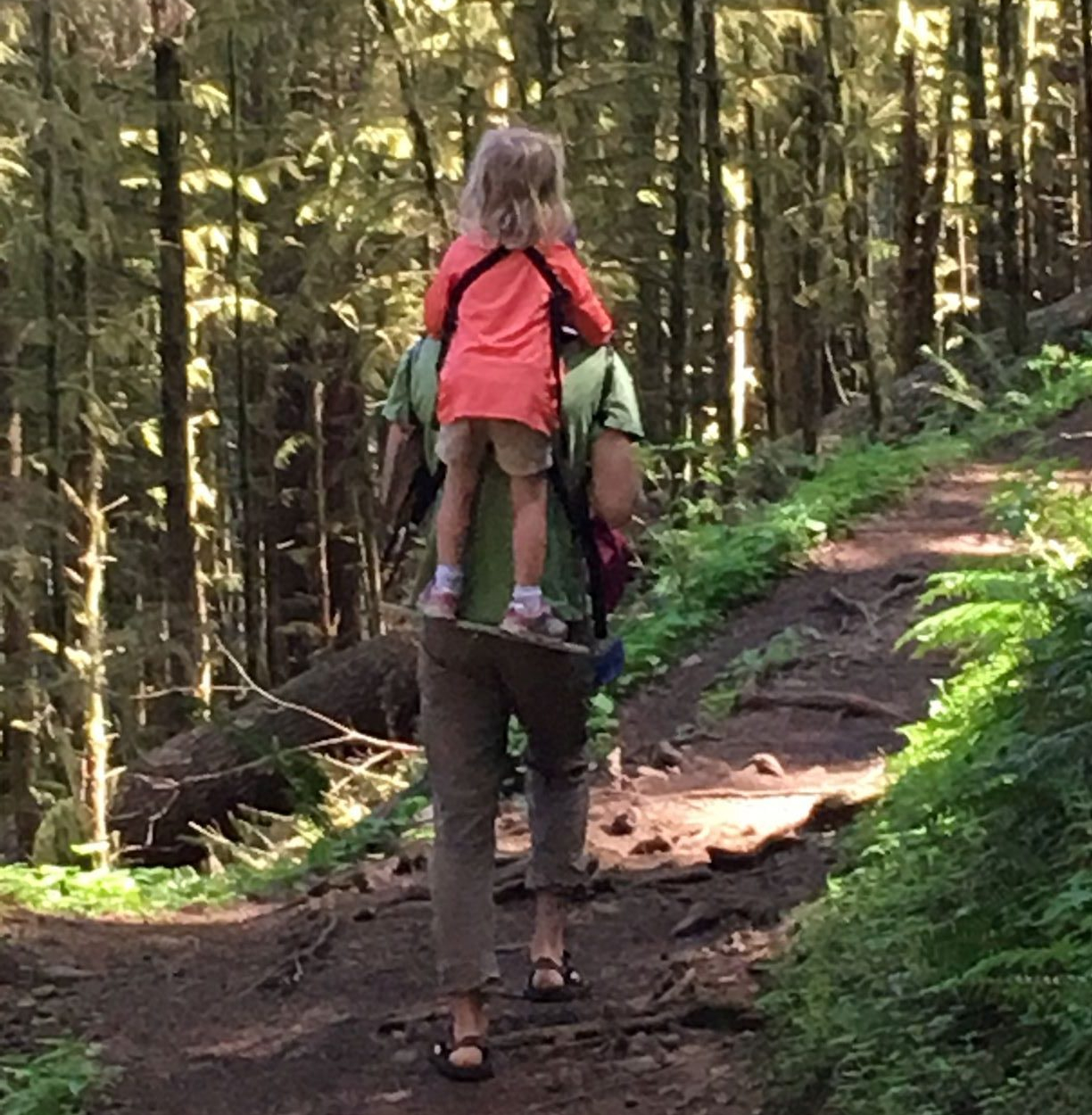
It is a steady but not impossible climb with plenty of chances to slow down and explore. We used our favorite kids carrier a few times, more so for fun than out of necessity.
Walking is good but a standing child carrier is great
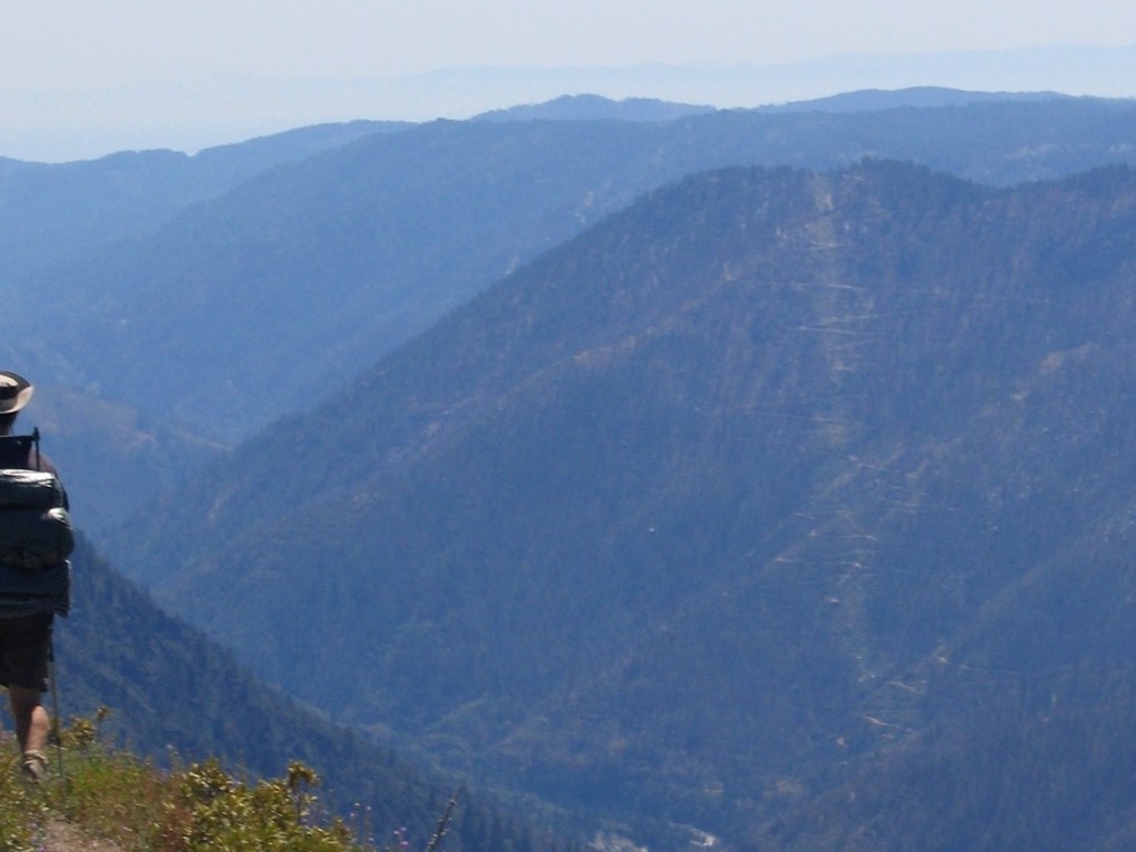
For our hike, we opted for the shorter version. Once at the summit, we agreed that the effort to reward ratio of this hike was great! A short scramble at the top leads to some of my best views of Oregon’s coast.
Oregon Coast, looking south and beyond that as well.
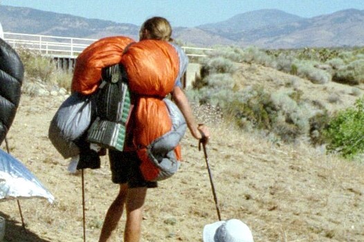
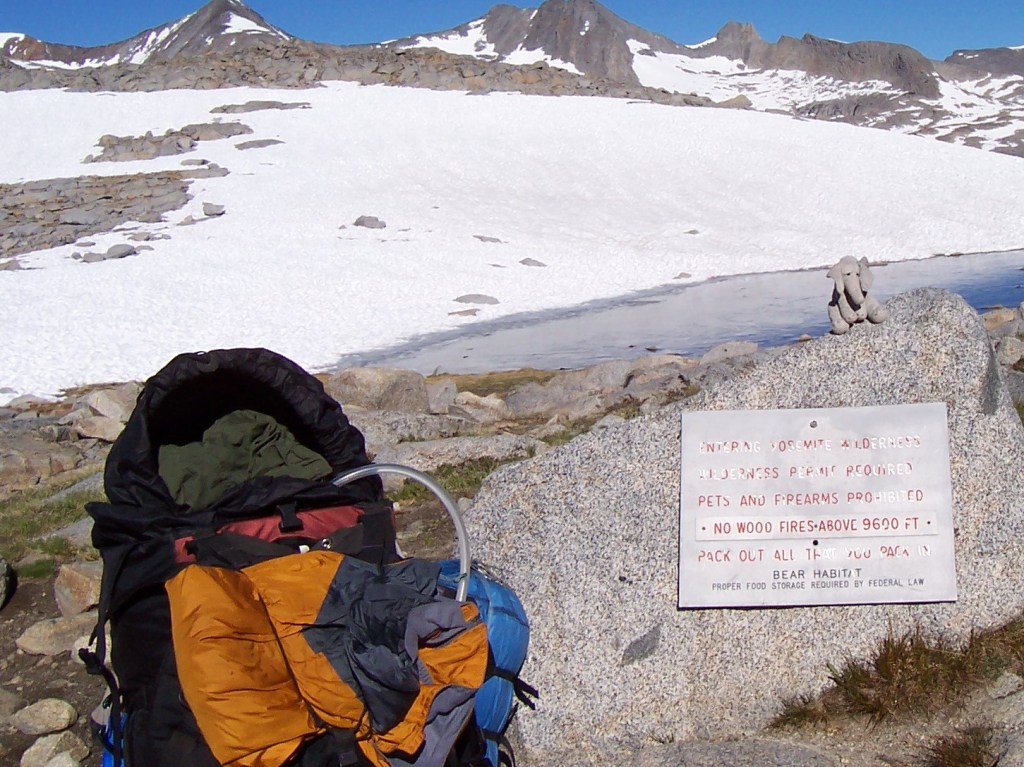
Are you considering a multi-day backpacking trip or a long thru hike, such as the Pacific Crest Trail? Do you wonder which things to pack for thru hiking the PCT?
You can benefit from our experiences thru hiking the PCT, the Vermont Long Trail, and the West Coast Trail. Here are a list of 10 things that we pack and love!
Hiking the PCT
Please note that this post includes affiliate marketing links. This means that we may benefit from a small amount of any purchase. This would be at no additional cost to you. We only endorse products that we use and love!
For Meals and Food:
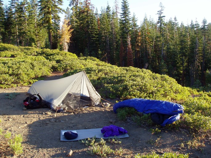
Ursack Allmitey Bear Bag. This works for rodents, as well as bears. CD used this for his thru hike in 2004 and we still use it today. You may consider sleeping with it under your pillow depending on how significant the rodent problem. It is durable, effective, and convenient. It is a must – have!
2. Titanium Spork. In the world of sporks, we vote for titanium. After breaking a couple of plastic sporks each, we decided to endorse something more durable. These have lasted us 5+ years and I anticipate that they will last at least another 5.
3. GSI Outdoors Infinity Backpacker Mug. CD did not have this on the trail as he was given it last year. He tells me that he would have taken it if he knew it existed. Apparently, he may consider taking it in place of water bottle. That is saying a lot since he was never far from his Nalgene when we first met.
4. MSR Dromlite Water Bag: 6 L. Methods for carrying water on the trail are a matter of personal preference and comfort . This is CD’s choice. More than 16 years later, it still has not gotten a leak.
5. Evernew Titanium Pot, 1.3 L. It is years later and this pot is still good as new. It is just the right size to feed one or two thru hikers or three or four car campers.
To Stay Warm and Dry:
1. Gators. There are different lengths, colors, and styles for different purposes. Wet grass, snow, mud, rain, and bugs are a few examples. Ours get a lot of use!
2. Camp socks. Spare socks for your sleeping bag are a must! You will thank us later! I currently love “Darn Tough” socks but any socks will work. CD carries three pair of socks. Two for hiking and one only for camp. He continues to stand the principle of camps socks. Whether we are home, in the Sprinter, backpacking, or car camping, we wouldn’t consider getting near our sleeping bags with anything other than our camp socks!
3. Marmot Driclime. This is my favorite layer of all time! CD thru hiked with in 2004 and still wears today. It works for any temperature, packs small, weighs little, and stands up to the challenge. He gave me a Marmot Driclime for my birthday the first year that we met and I was quickly convinced.
Advertisements
Advertisements
For Health and Safety:
1. Mosquito Head Net. When you need this, you will be glad it is packed. It is small, versatile, light, and effective. We recommend wearing it over a sun hat with a brim all the way around. This will keep the net from sticking to your skin or being irritating.
If you are seeking a different perspective, you can check out the “what I didn’t need” gear list from REI. You may notice some healthy differences of opinion that are worth checking out!
My husband was a thru-hiker. Here are some of the habits that I assume he picked up on the trail.
Disclosure: Please note that this post contains affiliate links. This means that we may get a small commission if you click a link and purchase something that we recommend. Clicking these links will not cost you extra money but will help us grow our website. Thank you for your support!
1. He drinks the dish water from the pot, even when car camping with a potable water source. This is not my favorite.
#PCT
2. He puts on his “camp socks” for sleeping and insists that everyone in the family do the same.
He also has sleeping socks at home as well.
3. He makes a solid argument that floor-less tarp tents are better than traditional tents for avoiding rodents.
He argues that while they may not keep rodents out, a tarp tent at least doesn’t keep rodents in. I can’t really argue with that I guess.
#PCT
4. He can wear gators pretty much anytime and has gators for any occasion.
#PCT
5. He doesn’t understand why people exercise when they should just thru hike.
“They should go outside.”
Notice the switchbacks. #PCT
6. He wears layers all the time, even to go the grocery store.
He adds layers and takes off layers constantly. The sun is shining and a layer comes off. The sun is behind a cloud and a layer goes on. Our kids do this as well and it is exhausting.
#PCT
7. He anticipates river crossing, even on day hikes.
He sometimes crosses rivers that we don’t even need to cross or at least he talks about how to cross rivers that we don’t need to cross.
8. He keeps his things in tiny bags and boxes. Seriously, he has endless tiny bags.
#PCT Kennedy Meadows
9. Pack weight is a constant concern, even on grade school field trips.
#PCT
10. He doesn’t know the day of the week, time of day, or federal holidays but he can tell you how to find the nearest mountain pass.
Thru Hiker For the Win.
To learn more about the PCT and CD’s thru hike, you can check out these links!
CD’s PCT thru hike trail journals are interesting. The common themes are food, water, dust, heat, sleeping, walking, and people. It all seems pretty basic really.
Meadow track to Warner Springs. #PCT
Warner Springs offered CD an introduction to the thru hiking community. He left town with a group of 15 or so hikers and they stayed together through a hot springs North of Lost Valley Road, I think.
Looks like Truffula Trees. #PCTHot Springs North of Warner Springs. #PCT#PCT
They rinsed clothes and soaked their joints. Local characters gathered there as well included a local stripper and a guy that carried his pipe, which he preferred to light with a magnifying glass, on a string around his neck.
CD and the pipe guy went to town and returned with watermelon. Apparently watermelon is not common on thru hikes and it was a big hit!
Phlox in the burn. #PCT
That time that CD left me on the road in order to give some thru-hikers a lift to town.
I have had only one experience on the PCT in southern California. CD and I were driving from Palm Dessert to San Diego. As we approached the PCT, I could feel CD’s excitement. I could tell that he really wanted to be a trail angel for someone.
We rolled over a hill in our Honda Civic hatchback and saw two hikers waiting for a ride to town. CD pulled over before he could even tell me his plan. Next thing you know, the two hikers, their packs, and CD were out of view and I was standing on the edge of the road.
It was me, tumbleweed, and the hundreds of rattlesnakes that obviously lived there.
I was out of place in clean clothes, sandals, and with my purse over my shoulder. Another set of hikers showed up from the South. They stopped to chat. They had met on the trail in 2004, did not complete their hikes that year, but went on to get married. On the trail again, they were hoping to complete it this time. I was new to the secret code of “trail names” but we were able to figure out that they had been on the trail with CD in 2004. They had crossed paths in approximately the same section of the trail that we were on then. I thought of this today while reading their names in CD’s trail journal.
A short time later, they got picked up by a passing car. I reached back to the old fashioned communication means of my youth and asked the hikers to send CD my way if they happened to see him hanging around town. I stood there, without a cell signal, waiting for CD.
More than an hour later he came back for me. It was fine. I was fine but I like to remind how about how he deserted me on the edge of the road during a hot day in the desert and didn’t pick me up until dusk.
This came out beautifully by accident. I love the frame of the moon. #PCT
It is spring in Utah when the rivers are running high, the sun is shining, and the roads are full of Colorado license plates. There is no better way to celebrate the end of ski resort employment than to leave the high country in favor of the red rocks of Utah.
I started this tradition prior to meeting CD and we continued it together every May until we moved from Colorado. Utah has so much to offer that I don’t even know where to begin. While the order is irrelevant, I will start southwest, go roughly northeast but stay south of I-70 and then end southeast near the four corners.
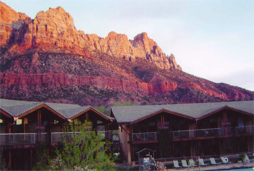
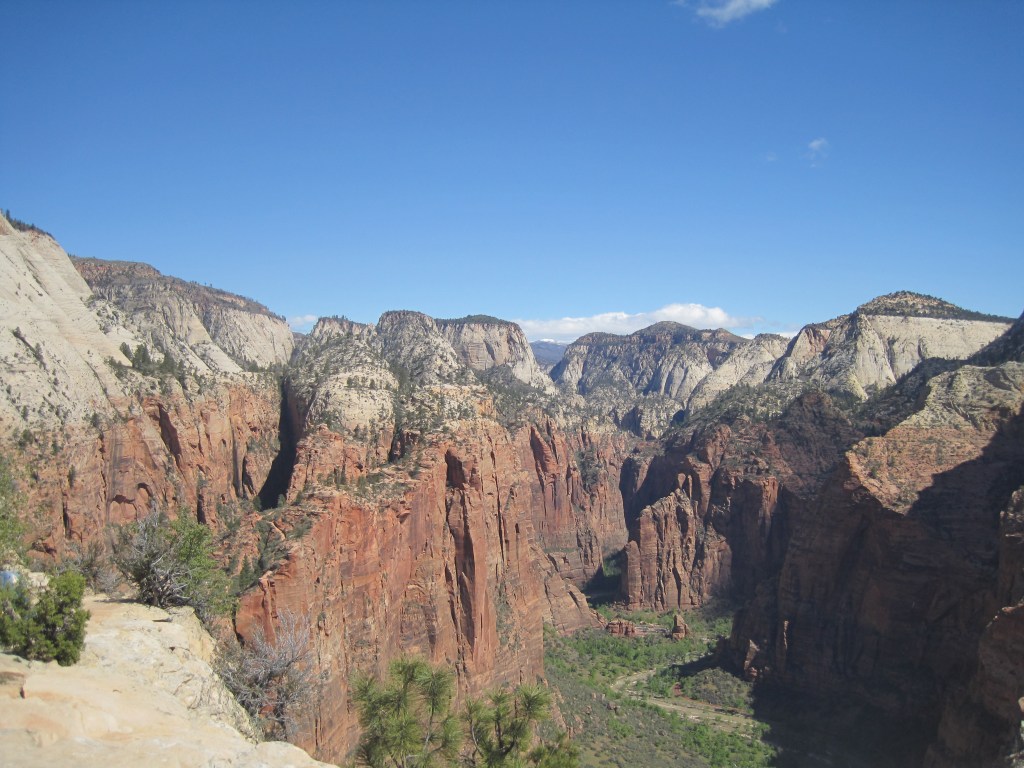
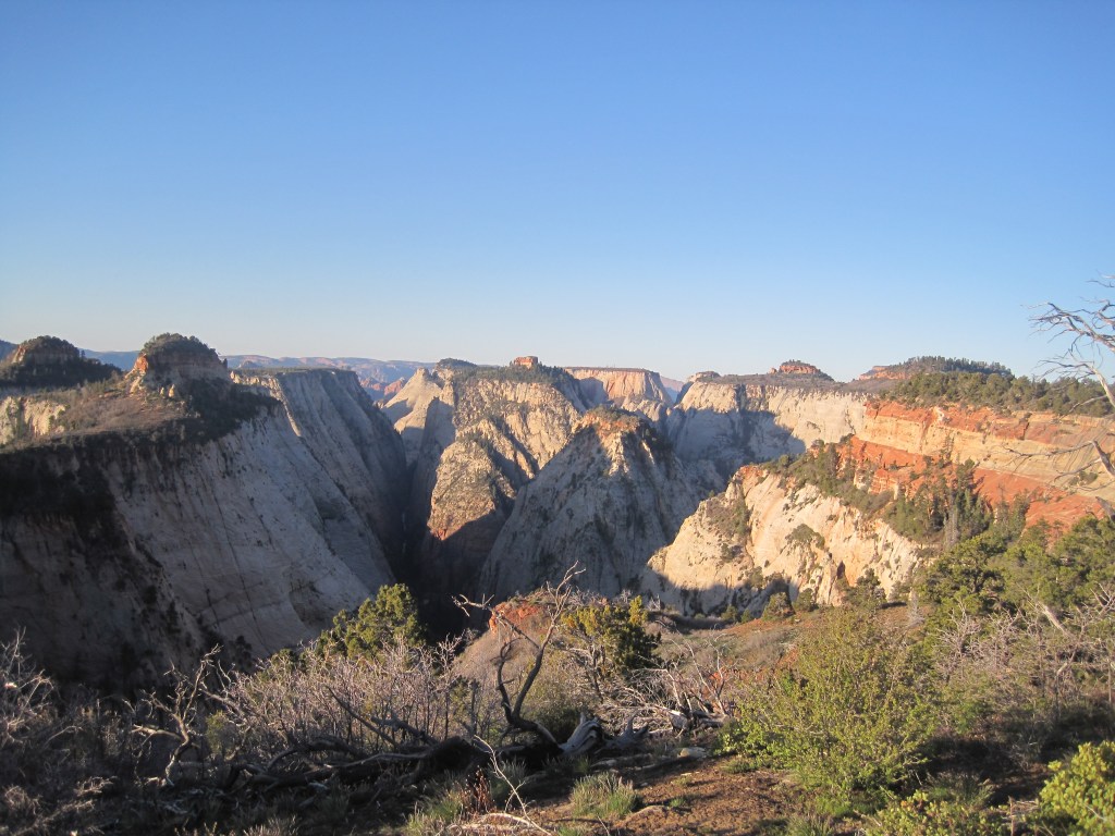
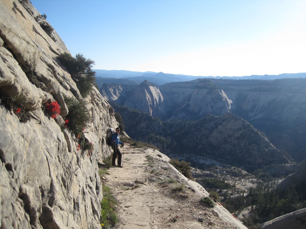
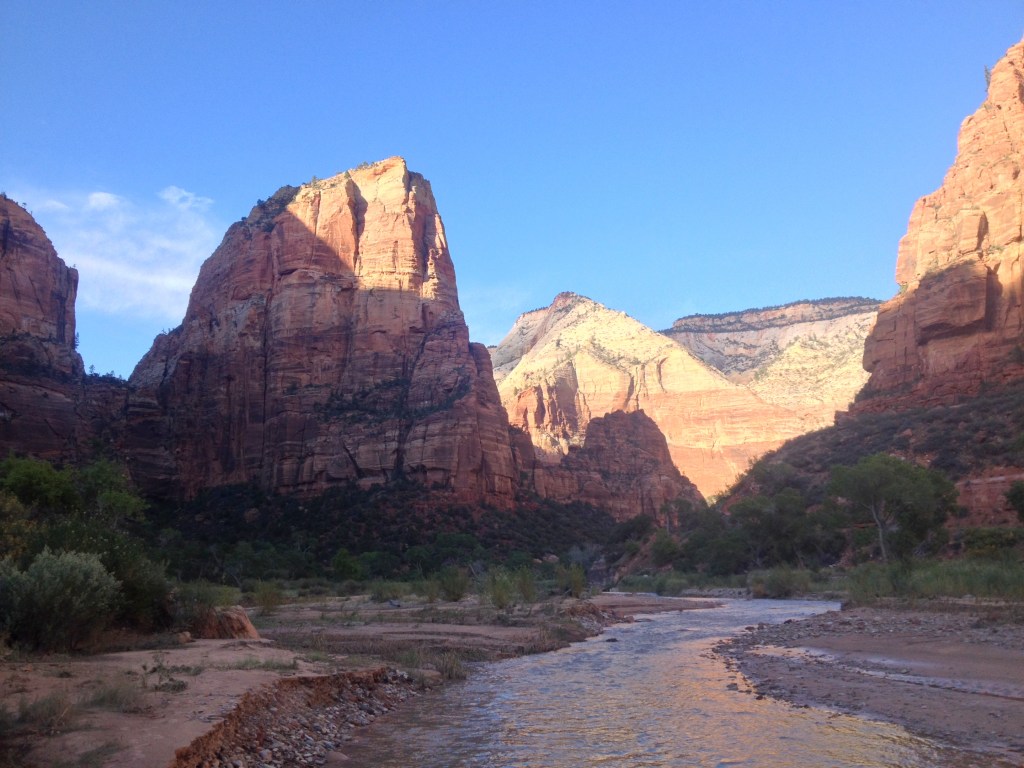
Zion National Park is my favorite, hands down. We have been there over and over. We have hiked end to end, climbed its peaks, and waded through its slot canyons. Its red rock is made more brilliant by the Virgin river and green trees. The proximity to the town of Springdale with its cold drinks and hot breakfast doesn’t hurt either.
The Desert Pearl, in Springdale. If you are looking for a break from camping, this place is unlikely to disappoint.
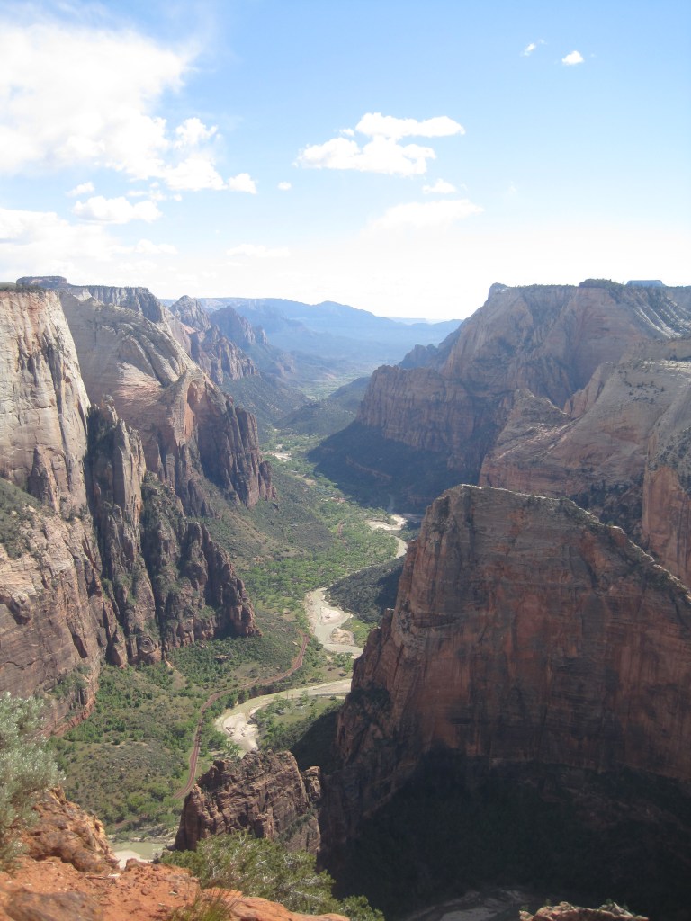
Angel’s Landing is its most well known hike. It starts with switchbacks called Walter’s Wiggles. It is well known that I love switch backs for the exercise alone. There is no better way to start the day.
It isn’t until after the switchbacks that this hike really separates itself from the rest. Angel’s landing is no joke in terms of exposure and drop offs.
The trail narrows to one way. There is a chain link railing. You are exposed to the depths of the valley floor, more so in some places than in others.
My first time up Angel’s Landing was with my brother. Making it to the top was a rush. Making it back down alive was even better. The next time was with CD. The rush was not as great but the feeling of relief after was even greater. The third time was with CD again. The steps felt more narrow and the valley floor seemed a bit further than before. With that, I decided that three times up Angel’s Landing is likely enough for me.
We looked for other routes with bigger and better views. Observation Point hit the mark. It is a more physically challenging and longer hike. It climbs 2100 feet and rises 700 feet above Angel’s Landing.
Zion, UtahAngel’s Landing
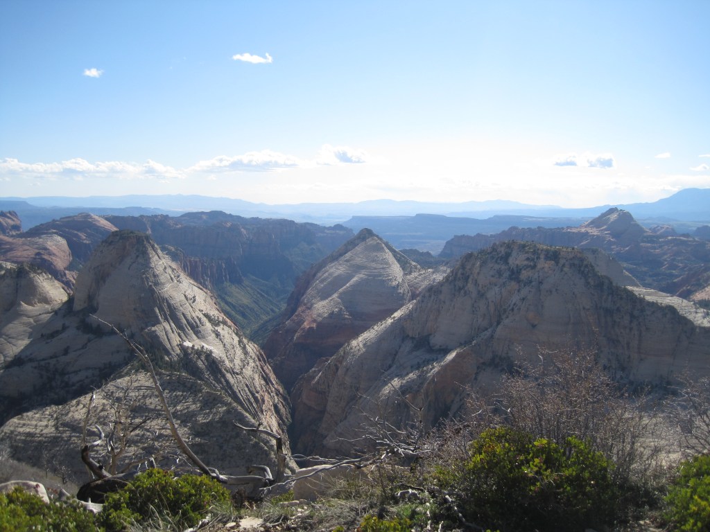
Zion, Backcountry
Back country sites are accessible from the main entrance. Below is the view from our camp site along the West Rim Trail. It is worth noting that we started the hike with a crowd headed to Angel’s Landing. As soon as we turned away from that route, we were on our own. It was super windy and we were surrounded by dead trees. We woke up in the morning to distance runners coming down the rim trail.
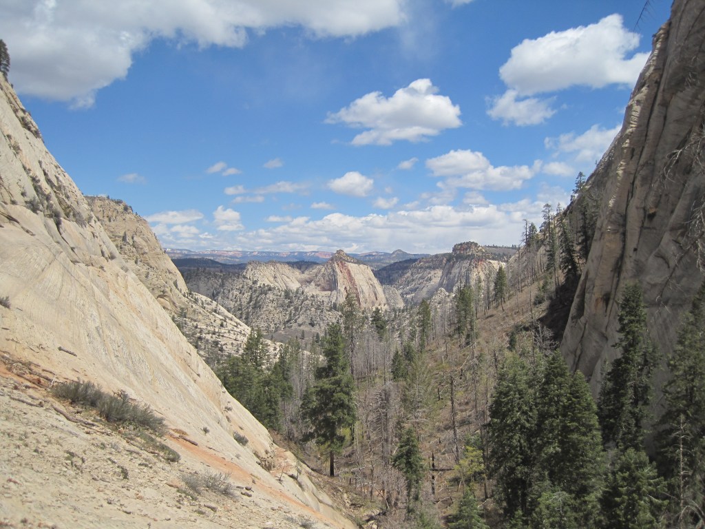
Zion, Kolob Canyon
Kolob Canyon is Zion’s less known North entrance. It offers day hikes and backpacking trips with few other people around. Our back country site was in an old river bottom. Much of the hiking was in loose sand. Snakes loved it.
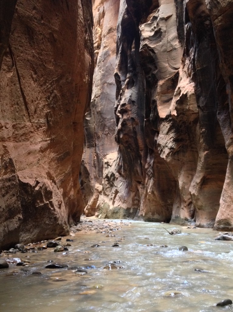
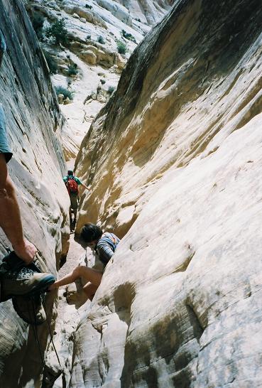
If you have seen the wide open spaces of Zion and are ready for a change, the Narrows may be your next stop. Do your research. Be informed. Watch the weather. These slot canyons are beautiful and it is good to pay attention if you plan to do much exploring. CD met a friend there for his fortieth birthday and they didn’t end up finishing their chosen route because of flash floods.
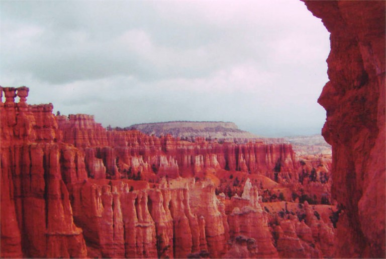
From Zion, you can get to Bryce Canyon in a short day. It is higher and cooler. This is great in the hot months and not as great in the early spring. It is smaller and more compact. The Hoo-doos are unique and impressive. I tend to pass through Bryce westbound to Zion or eastbound to Capital Reef but CD is a fan of the views at sunrise. He also has told me good things about a coin operated shower at the general store.
Apparently, he has a great memory of enjoying a post-hike beer from the general store while sitting on the lodge porch at sunset after a hot shower.
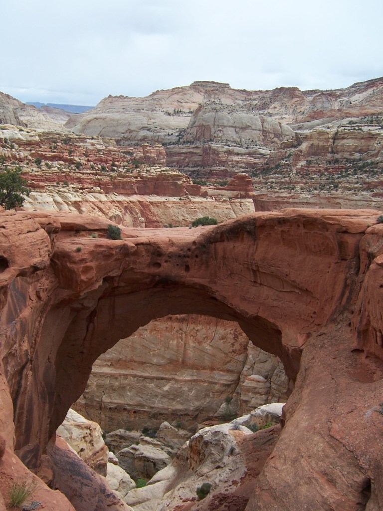
I rarely hear people talk about Capital Reef but we have found it to offer great hiking, impressive rock formations, and amazing views. I don’t recommend hiking there if you are hoping to meet people and chit chat over hand fulls of trail mix. The trails are largely empty.
At this point it is worth mentioning the San Rafeal Swell. It offers slot canyons with campsites tucked away on BLM land. My advice: Go there, if you have time. Bring your own shade. Do what I did and go with someone that has been there before – hopefully someone proficient at navigating slot canyons. Goblin Valley State Park is near by and may be a better choice if it is your first time in the area.
The price was right but shade was sparse. This was our route to enter the slot canyon.
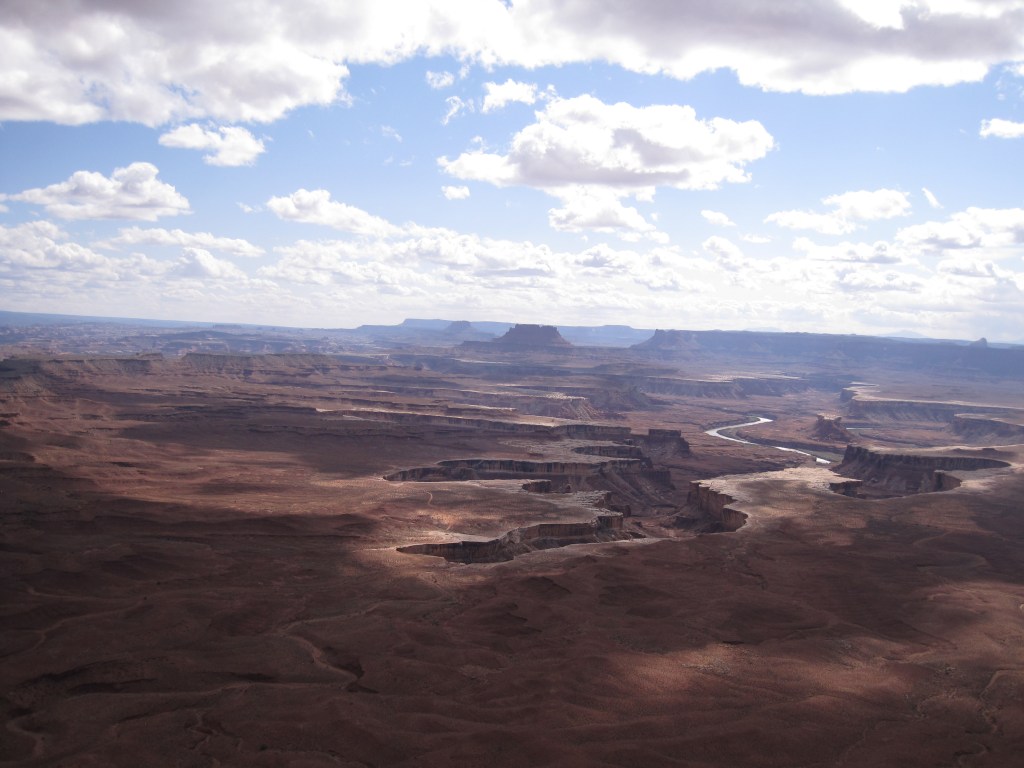
Canyonlands is easier to access from Moab than from the Southwest. The views are endless. The hiking is interesting and fun. Regions of the park have names like Needles, Island to Sky, and The Maze. Mountain biking the White Rim Road loop is popular and it is on my to-do list for sure. We have not camped in the back country but we have camped just outside the park and there are beautiful starry skies.
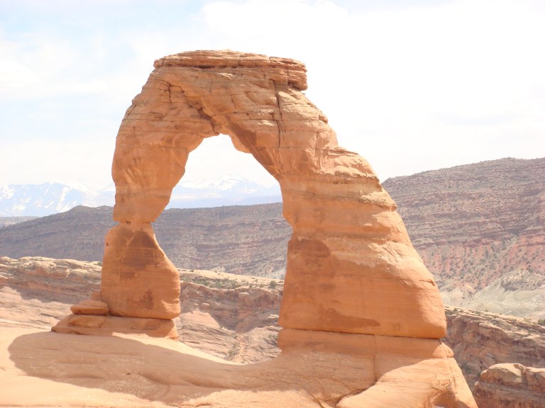
Arches is a straight shot from I-70 and is complimented by it’s close relationship with Moab. The Colorado River provides contrast to the red rock backdrop. The La Salle mountains rise up with snowy peaks and provide further contrast and depth to the scenery.
Moab is like the old west meeting a trendy art gallery. The restaurants and shops are full of personality and there are tour companies to suite everyone’s needs. You can sign up for 4 x 4 tours, mountain biking, hiking, river rafting, paddle boarding, horse back riding, and pretty much anything else you can imagine.
While I cannot speak to the tour companies, I can attest to the hiking and camping. Hikes range from easy to more difficult. Arches is typically one of the more crowded Utah parks but for good reasons. Campsites are dotted along the river banks and range from rustic and isolated to developed and popular. I recommend them all!
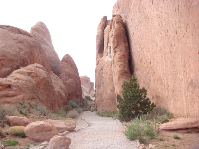
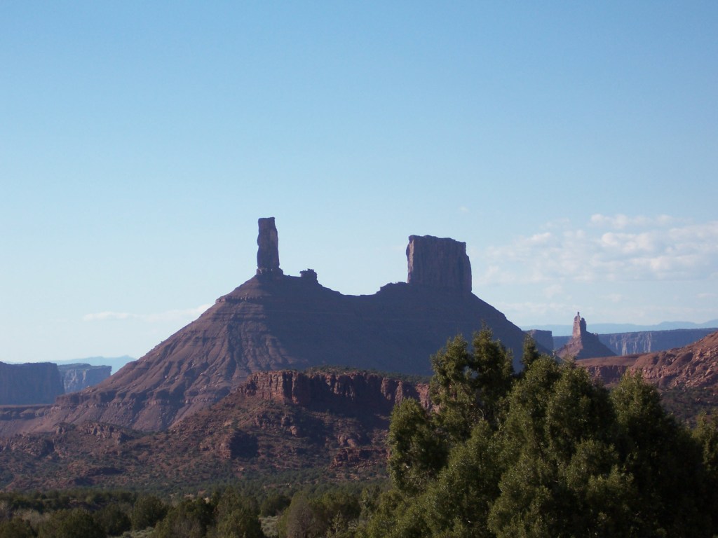
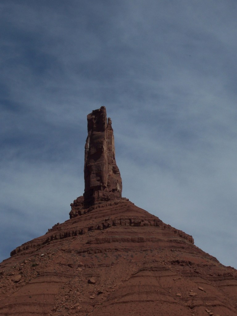
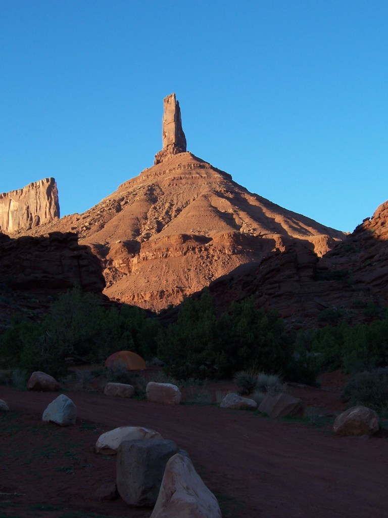
Just a bit East and on BLM land, you will find Castleton.
Castleton Tower from above the parking lot
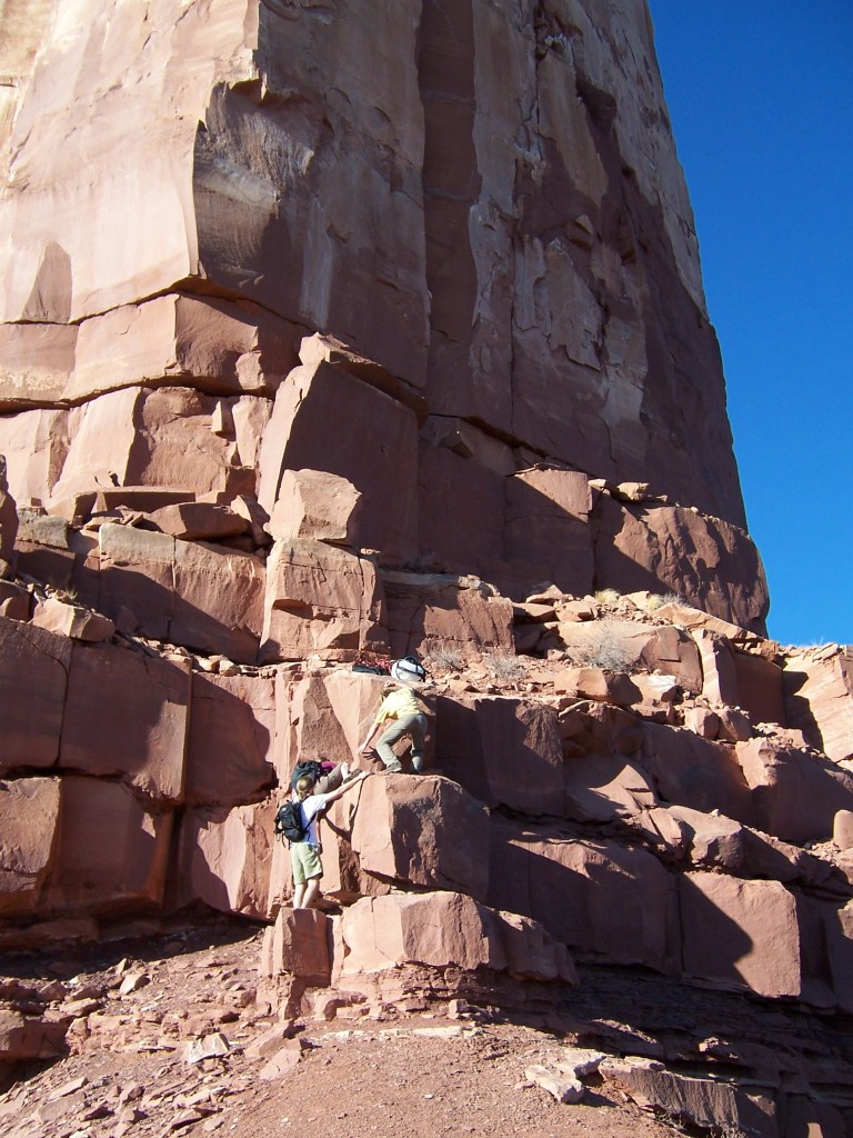
Pretty much everyone was there to climb. CD climbed with friends while I hiked and then read a book at the campsite. It was great. Everyone was happy.
Hiking up to start the climb. It looked taller in person. This is where I turned around and CD went upOur tent – in the shade!
If you don’t climb, it is still beautiful to see but you will likely enjoy camping somewhere else more than camping here. This was packed with climbers and surrounded by wide open desert.
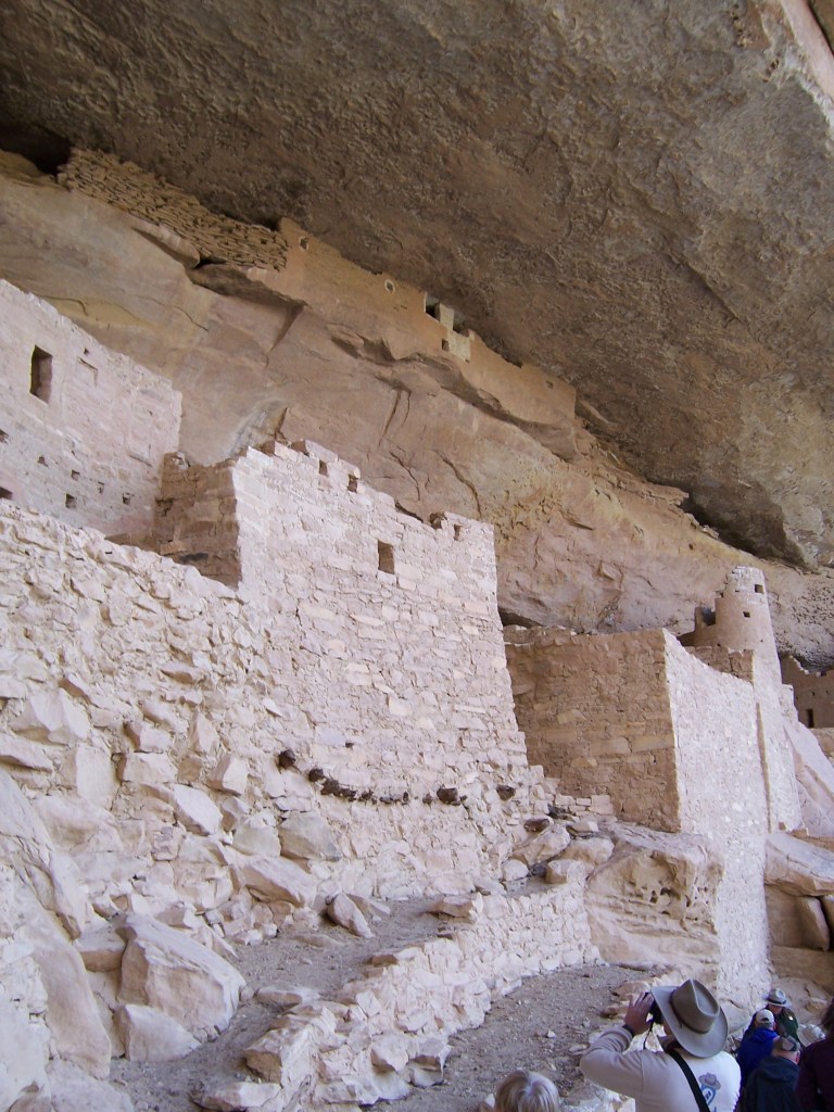
Dropping down to the four corners, you can hop into Mesa Verde. While the cliff dwellings are interesting and worth seeing, you may find a bit of crowd. My favorite feature is its proximity to Durango. Check out the Silverton Narrow Gauge railway and head North to Ouray or East towards Pagosa Springs on your way out of town.
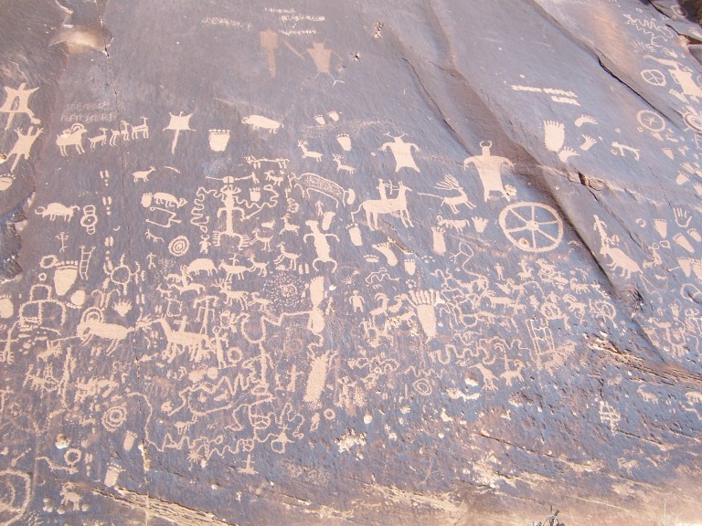
These petroglyphs are at Mesa Verde, Utah. You can see similar markings along I-70 just West of 191.
I could keep going on and on about Utah but will stop myself here for now. Utah is dense with natural wonders. I recommend going there and seeing it first hand.
Red rock dust from ten years ago still stains my hiking boots. Seeing it makes me smile.
Please consider following our blog for more adventures.
Here we were in the middle of an Oregon winter. The sun was shining. It was nearly fifty degrees. We are waist deep in home projects and ready for a stay-cation.
Sunday morning started off lazily but the sun was too tempting to stay home.
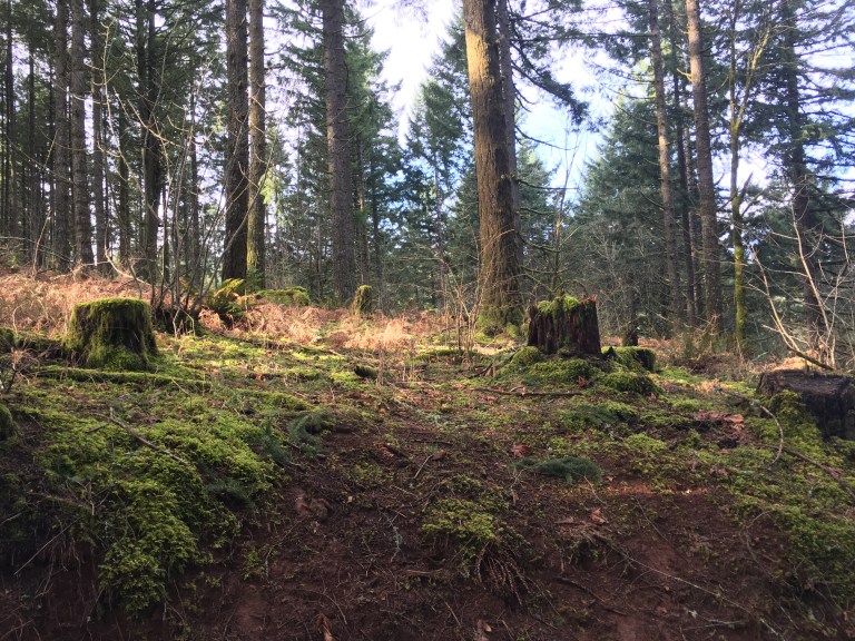
McDonald – Dunn Forest is a short drive from our house. Using my mom instincts, I packed a light lunch and spare socks.
Sitting in the van is like a breath of fresh air. There is something comfortable, simple and refreshing about it. I think we all feel it.
The Vineyard Loop: Oregon Winter
It is a well traveled 3.4 mile route with a view from the top. We like to sit and stare off into the distance. The kids made up a game where they were having a Superbowl party for cats and dogs. They walked and talked the whole way.
We spent an hour and half walking and a half an hour in the van.
Van Life: Memories of Summertime
The kids took theirs shoes off and hopped up on the bed. They looked out the window with the door open and the sun shining in. I got the snacks out but they didn’t eat. CD and I ate the cheese and crackers until it was time to go. I am sure that they would have stayed up there looking out all day.
Sprinter life requires a different pace. It is good to be reminded that a slower pace is just fine too.
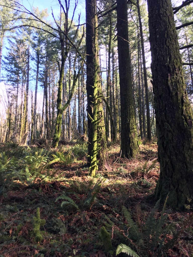
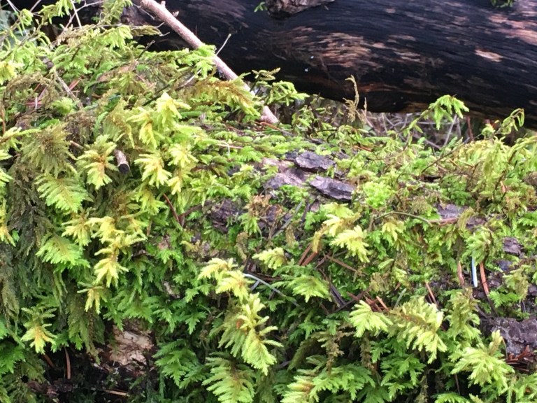
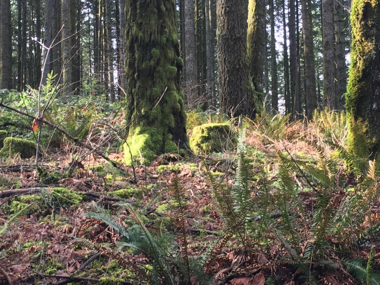
Our trailThe trail is easy to find. Trees and sky. A scene from a book. Our view was perfect. The end of the trail.The woods were green and wet with rain and it was a great day. The woods are thick and full of lichen, of course.
Some Colorado hikes are so great that it doesn’t seem right to put them out there on the internet for everyone to see.
Most places are already fully accessible online, however. They are all likely more crowded than before the internet existed. The crowds are not because of my little blog. In the interest of sharing some great spots, I will start will a great one.
Mayflower Gulch is the sort of hike that you see in magazines or on television. It is picturesque.
It was a weekday afternoon type of hike for us when we lived in Summit County. According to the internet it is a 5.9 mile loop. It didn’t seem that far. The trail head is less than 10 miles towards Leadville from I-70. The road is well traveled.
As with many hikes in the high country, I recommend it in the winter. With snow it is quiet and light. There will likely be a few other people there but they will all be smiling.
Skis with climbing skins, Nordic skis, snow shoes, or boots will all typically work well for this trek. Old mining cabins mark the end of the trail and offer a good place for lunch with a side of inspiration.